NOVA SCOTIA RESIDENTIAL DWELLING YEAR OF CONSTRUCTION
The interactive Nova Scotia Dwelling Age map was created using Residential Dwelling Characteristics dataset provided by the Property Valuation Services Corporation. The interactive web map is powered by Carto and Google Street View Image API.
Property Valuation Services Corporation is mandated under the Nova Scotia Assessment Act to assess every property in Nova Scotia, one of the variables that is collected is year of construction.
Use the map to zoom in and see how areas of Nova Scotia have developed over time and when. You can hover over a dwelling point to see the address and year of construction.
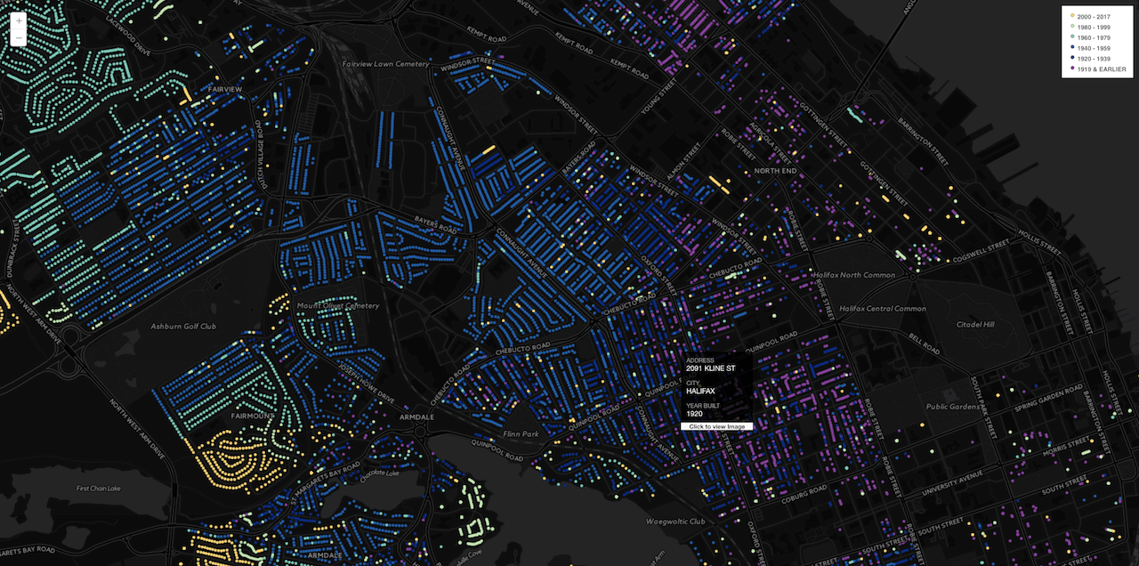
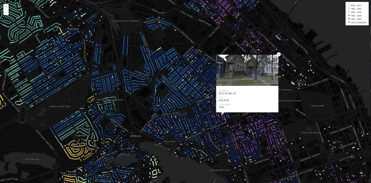
Click on a point to display a picture of the development. The Google Street View Image API allows the user to view the property based on best available Street View imagery when clicking on an address point.
An animated map was also created using Torque to help explore the spatio temporal growth of residential dwelling development in Nova Scotia, from the first year of constuction in the dataset 1469 to 2017, available here.
A special shout out to Eric Rapaport who made me aware of the data and provided inspiration for the maps through his own work.