Lightsavers National LED & Connected Streetlight Inventory Map
This interactive web map was created for Lightsavers using NASA World at Night map tiles and the Carto service.
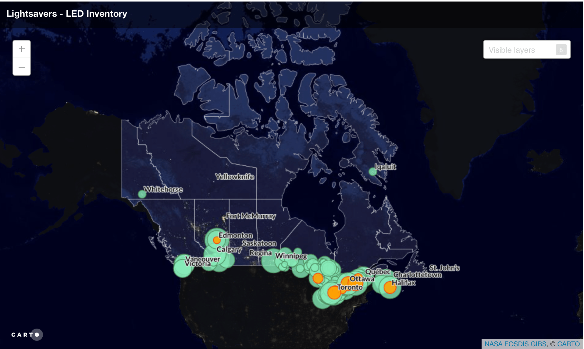
The map displays projects across Canada where LED streetlight conversions and streetlight control systems have been completed, are being installed or have been approved for installation.
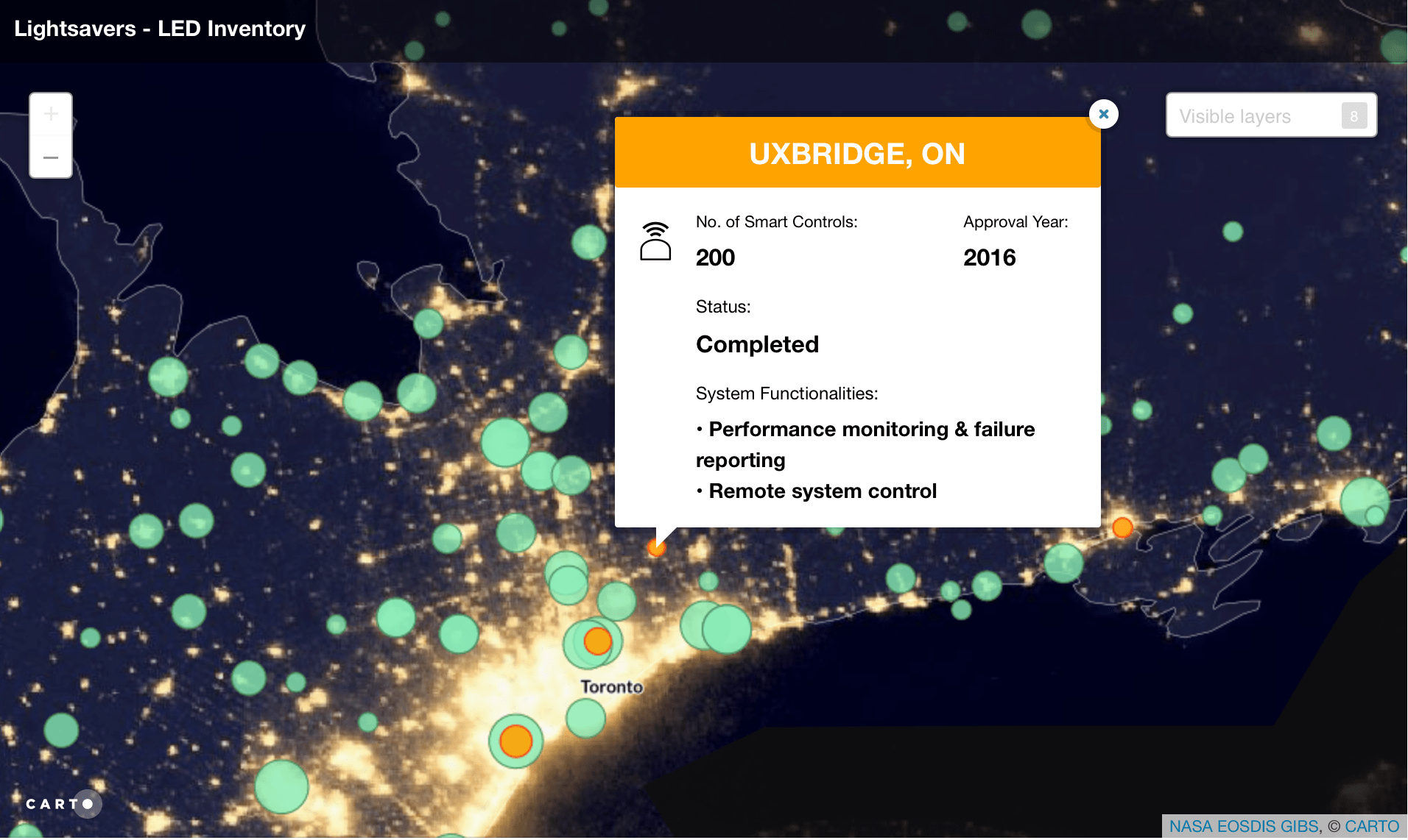
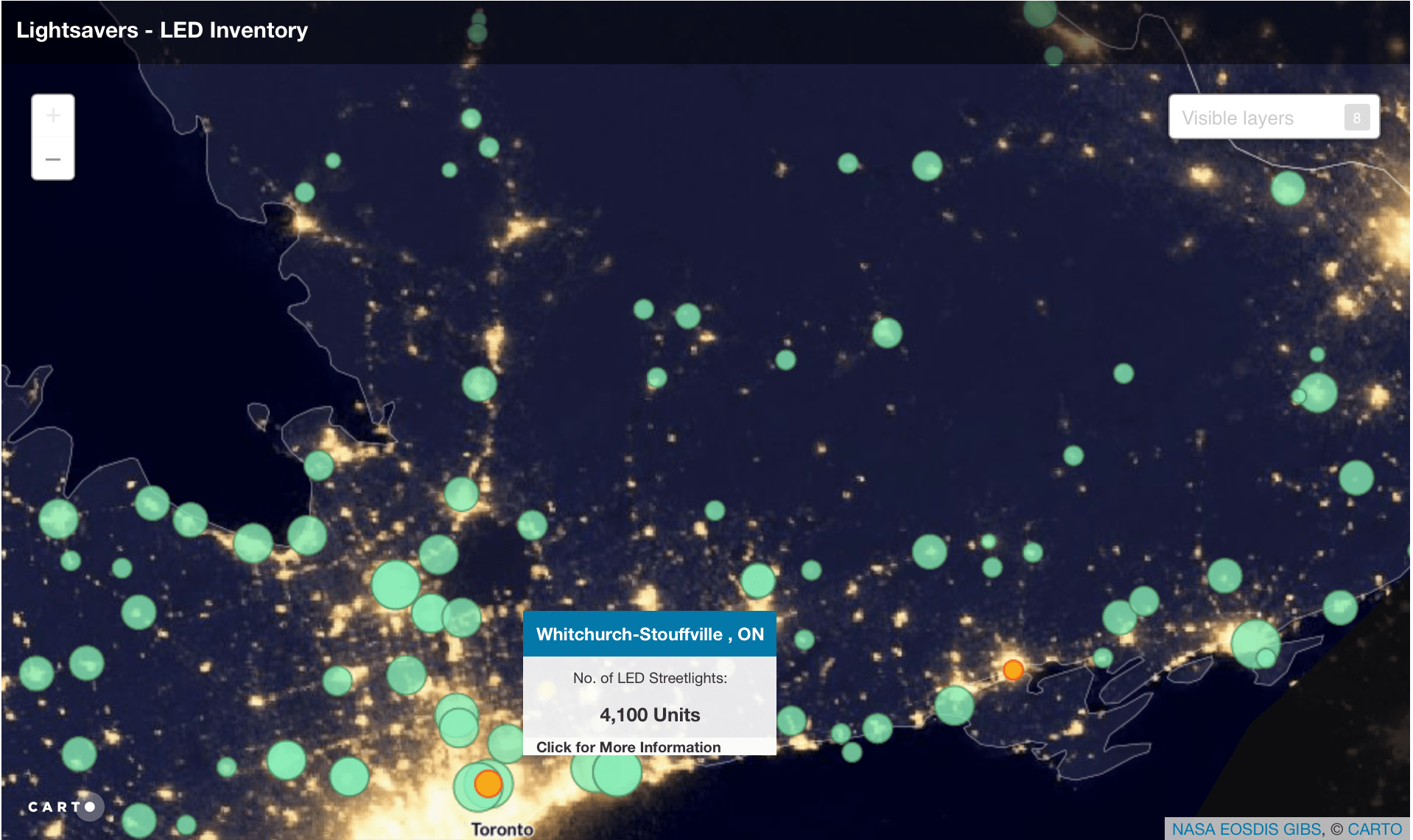
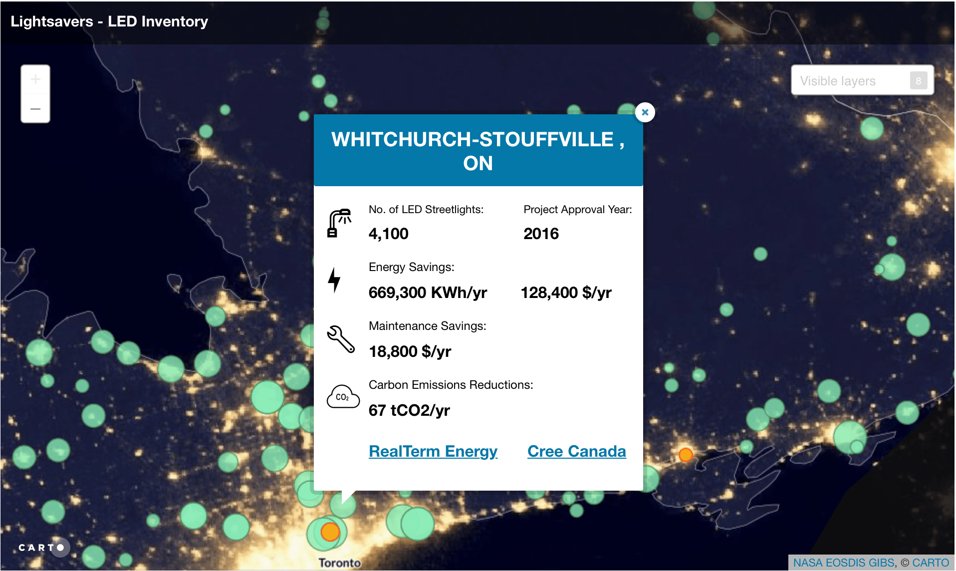
Users can click on a city to learn more about how many streetlights are LED, the energy and maintenance savings and potential greenhouse gas reductions, and if adaptive controls have been integrated.
The project required the design and creation of custom popups including icons.
Web Map
National Perspective
LED Streetlight Hover
LED Streetlight Popup
Control Systems Hover
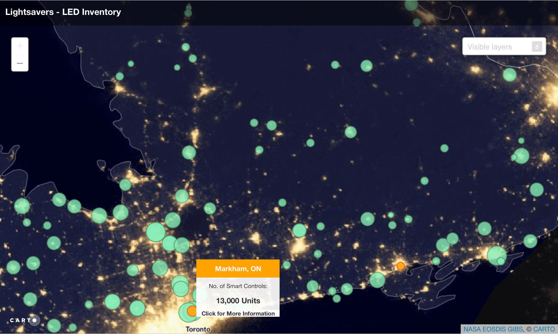
Control Systems Popup