Nova Scotia, Physical Infrastructure at Risk of Flooding due to Climate Change-Induced Sea Level Incursion
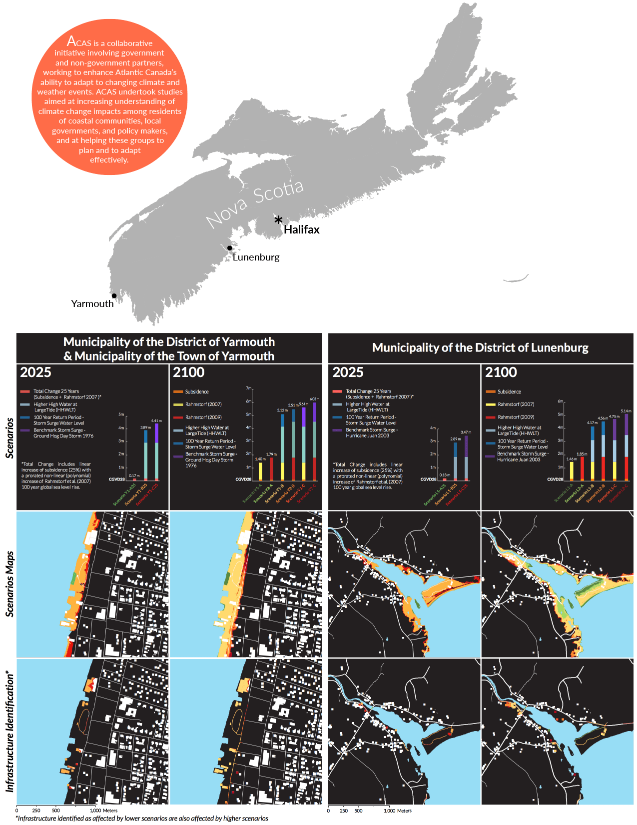
Over the summer of 2011, I was a member of the Dalhousie University School of Planning team that conducted studies in three Nova Scotia Municipalities (Municipality of the District of Lunenburg, Municipality of the District of Yarmouth, and the Municipality of the Town of Yarmouth), as part of the Atlantic Climate Adaptations Solutions (ACAS) initiative, mapping future sea level rise and extreme water level scenarios using Light Detection And Ranging (LiDAR) elevation data.
The projects involved researching and developing localized scenarios, employing geospatial technologies in mapping these scenarios using the detailed elevation data, and creating overlays to identify vulnerable municipal infrastructure. The projects produced materials outlining the variables incorporated in developing future scenarios and spatial datasets used to create maps identifying areas and infrastructure vulnerable to sea level rise incursion.
Links to Reports
Project Summary